With a series of Blueway trails – 160km in total of shoreline paddling trails to be explored on the Lough Derg Blueway, the Portumna to Kilgarvan Quay trail consists of five individual journeys guiding the user between access points along the trail.
Portumna to Kilgarvan
tabbed section Portumna
Paddling from Portumna to Kilgarvan
Showing n-m of p results
Skip the list-
Trail difficulty level Beginner
- 4.75 km
- 1h 35m
- Loop
Portumna Water Recreation Park to Hayes Island
Portumna Water Recreation Site to Hayes Island
Distance
4.75 km
Duration
1h 35m
Start point
Portumna Water Recreation ParkEnd point
PortumnaDifficulty
Beginner
Description
Travel left (East) when you depart from the recreation park and then enter the Shannon river where you see the navigation markers. There can be rough water where the Shannon enters the lake and travelling upstream can be difficult in high river flows, also avoid the angling stands on your left. Paddle under the N65 bridge and then return on the other side of Hayes Island. Be aware that motor cruiser and water ski craft in the river can create large wakes.
-
Trail difficulty level Intermediate
- 6 km
- 2h
- Linear
Portumna Water Recreation Park to Portumna Forest Park
Distance
6 km
Duration
2h
Start point
Portumna Water Recreation ParkEnd point
Portumna Forest ParkDifficulty
Intermediate
Description
Paddle from the recreation park along the bank on the right (West) and cross the entrance channel to Portumna Marina (0.5 km). The tree lined shore of Portumna Forest Park with small bays and headlands is in front of you. At the large headland at Rinmaher the lake bank turns to the right and you enter a large bay with ten small scattered islands. The largest on the inside curve of the bay is Church Island and during March to July, please stay at least 250 metres away as the White Tailed Sea Eagle will be nesting then. When you round the next large headland, you may see one of the forest park’s walking trails and if you want to stop in the forest park for lunch or a walk, bring or download a copy of Coillte’s Portumna forest park’s map on your phone.
Coillte have partnered with HiiKER and you can download the app with detailed information on Portumna forest at this link HiiKER App Portumna Forest. -
Trail difficulty level Beginner
- 3 km
- 1h
- Linear
Portumna Water Recreation Park to Terryglass Harbour
Distance
3 km
Duration
1h
Start point
Portumna Water Recreation ParkEnd point
Terryglass HarbourDifficulty
Beginner
Description
Travel left (East) when you depart from the recreation park and then cross the mouth of the Shannon river where you see the navigation markers. Follow the bank to the white stone cairn and then cross to Terryglass on your right at the closest point (600 metres wide). There are good views down the lake from here. Take care crossing the river in high flows and also when crossing the open water to Terryglass harbour. Avoid this crossing if there is wind and it is advisable to have the option of stopping the journey in Terryglass. This journey may become Intermediate grade in windy conditions.
-
Trail difficulty level Intermediate
- 8.7 km
- 3h
- Linear
Terryglass Harbour to Kilgarvan Quay
Distance
8.7 km
Duration
3h
Start point
Terryglass harbourEnd point
Kilgarvan QuayDifficulty
Intermediate
Description
Turn left (West) on leaving Terryglass and look out for Old Court Castle and the little hidden harbour as you travel towards the Gortmore harbour (1.6 km) just before the headland. Pay attention to the wind on the other side of this headland and if necessary reconsider our intended trip. After rounding the shelter of this headland you traverse a large bay with a protruding strip of land, and then a smaller bay, where you can see the remains of Drominagh castle and the mouth of the Ballyfinboy river which you may be able to travel up. Cross the next bay and find the unmarked reed channel close to the shore and after a private reed channel which is marked by a blue buoy. You can then exit from the slip in Kilgarvan quay.
-
Trail difficulty level Intermediate
- 8.5 km
- 2h 50m
- Loop
Terryglass Harbour to Slevoir Bay Loop
Distance
8.5 km
Duration
2h 50m
Start point
TerryglassDifficulty
Intermediate
Description
An enclosed bay which is suitable for guided intermediate paddlers and for independent intermediate paddlers capable of self-rescue. The crossing of Slevoir Bay at Terryglass must not be undertaken in windy conditions.
Turn right on leaving Terryglass and travel North to the start of the bay (0.7 km), then cross the 600 metre open water crossing to the far side of the bay. Once across, turn right (East) into the bay and follow the bank in a horseshoe loop back to Terryglass. Note that access to the land is poor for large parts of the Northern side of the bay.
No results to display here yet, please check back soon.
Walking trails around Portumna
Showing n-m of p results
Skip the list-
Trail difficulty level Moderate
- 98.3 km
- 30h
- Linear
Hymany Way
100 km walk traversing beautiful and unexplored local scenery.
Distance
98.3 km
Duration
30h
Difficulty
Moderate
Description
The Hymany Way, one of a series of 11 sections of the greater Beara Breifne Way, goes in a northerly direction on the western side of the Shannon tracing the epic march of O Sullivan Bere from the Beara peninsula.
-
Trail difficulty level Moderate
- 10 km
- 2h
- Loop
Portumna Forest - Bonaveen Walking Trail
Lengthy loop through diverse forestry and open lake shores.
Distance
10 km
Duration
2h
Start point
Portumna Forest ParkDifficulty
Moderate
Description
This trail is the longest loop through a variety of trees and open lakeshore. It covers the Western side of the park and includes the wonderful Bonaveen Point section by the lake. It is on single track which is narrow and twisty in places. The long section around the lakeshore is some of the most attractive landscape in the park with great views out over the expanse of Lough Derg. This trail is open to bad weather at times and can be quite exposed.
-
Trail difficulty level Moderate
- 10 km
- 2h
- Loop
Portumna Forest - Rinmaher Walking Trail
Tranquil wooded glades and stunning lakeshore views.
Distance
10 km
Duration
2h
Start point
Portumna Forest ParkDifficulty
Moderate
Description
This loop is mainly on single track narrow trails and is suitable for those looking for a longer walk. It begins along a two-way section of trail and covers much of the Park. There are good views along the lakeshore near Rinmaher Point south towards Terryglass and East towards Portumna Bridge. Signal signs provide information about local features of fauna and flora, including red squirrel and fallow deer.
-
Trail difficulty level Easy
- 2 km
- 25m
- Loop
Portumna Forest - Woodland Walking Trail
Family-friendly walk with lake views and a duck pond.
Distance
2 km
Duration
25m
Start point
Portumna Forest ParkDifficulty
Easy
Description
This trail can be used by family walking groups. The surface is gravel; tarred forest road, wide timber boardwalk and there is a narrow section of trail. The gradient is minimal. It begins along a two-way section and includes an open area, the viewing platform and the duck pond. The viewing platform looks out across Lough Derg and its islands and Southwards towards Terryglass while to the right the main expanse of the lake can be seen.
-
Trail difficulty level Easy
- 1.4 km
- 20m
- Loop
Portumna Forest Friendly Walking Trail
Gentle forest stroll on smooth trail and timber boardwalk.
Distance
1.4 km
Duration
20m
Start point
Portumna Forest ParkDifficulty
Easy
Description
This trail is on wide and smooth forest road and wide timber boardwalk. It winds gently through trees to a viewing platform close to the shore and on to the duck pond before returning to the car park. The viewing platform looks out across Lough Derg and its islands and Southwards towards Terryglass while to the right the main expanse of the lake can be seen.
-
Trail difficulty level Easy
- 2.5 km
- 30m
- Loop
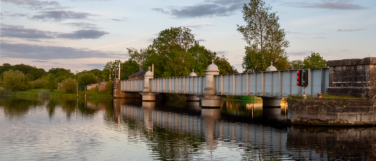
Portumna Harbour to Bridge Trail
Tranquil walk through verdant scenery to Portumna Bridge.
Distance
2.5 km
Duration
30m
Start point
Portumna harbourEnd point
Portumna BridgeDifficulty
Easy
Description
Join the trail either from Portumna Harbour or Portumna Lifting Bridge. Enjoy panoramas across the expanse of Lough Derg as you follow this flat and easy route, passing the Water Recreation Park along the way.
No results to display here yet, please check back soon.
Cycling trails around Portumna
Showing n-m of p results
Skip the list-
Trail difficulty level Beginner
- 10 km
- 40m
- Loop
Bonaveen Cycling Trail
Portumna Forest Park - Bonaveen Cycling Trail
Distance
10 km
Duration
40m
Start point
Portumna Forest ParkDifficulty
Beginner
Description
This trail is the longest loop through a variety of trees and open lakeshore. It covers the Western side of the park and includes the wonderful Bonaveen Point section by the lake. It is on single track which is narrow and twisty in places. The long section around the lakeshore is some of the most attractive landscape in the park with great views out over the expanse of Lough Derg. This trail is open to bad weather at times and can be quite exposed.
This trail is open and flowing with gentle gradients and, while not technically challenging, is best experienced on a mountain bike. -
Trail difficulty level Easy
- 2.5 km
- 10m
- Loop
Harbour to Bridge Cycling Trail
Tranquil walk through verdant scenery to Portumna Bridge.
Distance
2.5 km
Duration
10m
Start point
Portumna HarbourEnd point
Portumna BridgeDifficulty
Easy
Description
Join the trail either from Portumna Harbour or Portumna Lifting Bridge. Enjoy panoramas across the expanse of Lough Derg as you follow this flat and easy route, passing the Water Recreation Park along the way.
No results to display here yet, please check back soon.
.webp?ext=.webp)
.webp?ext=.webp)
.webp?ext=.webp)