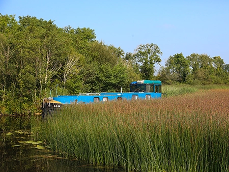
With a series of Blueway trails – 160 km in total of shoreline paddling trails to be explored on the Lough Derg Blueway, the Mountshannon to Rossmore trail consists of five individual journeys guiding the user between access points along the trail.
Mountshannon to Rossmore
Paddling from Mountshannon to Rossmore
Showing n-m of p results
Skip the list-
Trail difficulty level Intermediate
- 3.8 km
- 1h 20m
- Linear
Dromann Harbour to Church Bay
Rossmore Pier to Illaunaboe Quay
Distance
3.8 km
Duration
1h 20m
Start point
Dromann HarbourEnd point
Church BayDifficulty
Intermediate
Description
This is relatively sheltered initially but can be exposed to wind and wave activity in the last kilometre. Suitable for intermediate paddlers capable of self-rescue.
Leave the long channel out of the well sheltered and attractive Williamstown harbour and travel straight ahead (South) across the small inlet to the narrow tree lined point (600 metres). Continue South West past the small cluster of lake-shore houses (1.3 km), to the headland at Ashbrook which you round. This area can be the windiest part of your journey so be prepared to turn back here if it is prudent to do so. You pass the slight bay to the next headland / island (3.5 km), and then turn right (North) into the small Church bay and the small harbour at its end.
-
Trail difficulty level Intermediate
- 8.75 km
- 3h
- Linear
Dromann Harbour to Illaunaboe Quay
Distance
8.75 km
Duration
3h
Start point
Dromann HarbourEnd point
Illaunaboe QuayDifficulty
Intermediate
Description
Exposed to wind in places and close to the navigation channel, suitable for intermediate paddlers capable of self-rescue.
Turning left (North) as you leave Williamstown harbour, you pass private marinas and the public shore road (1 km). There are a number of small bays to explore, look out for the two busts on the navigation markers near to the big island ‘Illaunmore’ (3 km). There are a number of small islands and then you cross two and then a third small bay. This section has few areas to land on. After the farmland you enter another area of reeds, look carefully here for a narrow channel (7.3 km), nearly a kilometre long which brings you to an interior hidden small lake Lough Alewnaghta. Otherwise follow the bank North and you will see a short reed channel to a slipway and the car park at Illaunaboe Quay.
-
Trail difficulty level Beginner
- 3.3 km
- 1h 10m
- Loop
Mountshannon Harbour to Cloonoolia Bay
Distance
3.3 km
Duration
1h 10m
Start point
Mountshannon HarbourDifficulty
Beginner
Description
A section of this trail is possible for guided beginner paddlers, depending on their ability and fitness. Suitable also for self-led intermediate paddlers.
This trail explores two close-by and relatively sheltered bays. Start in Mountshannon Harbour or at the swimming area and turn left (East) in the direction of Mountshannon Bay (500 metres). You’ll notice a private marina on the Northern shore of the bay. Continue along the shoreline of the bay, then pass around the tree lined Dooros point (800 metres), with Mountshannon campsite and harbour on your left. Rounding Dooros Point brings you to the entrance of the much wider Cloonoolia Bay. The small harbour on its Eastern shore marks your turning point to return to Mountshannon. This journey may become Intermediate grade in windy conditions.
-
Trail difficulty level Beginner
- 2.5 km
- 50m
- Linear
Mountshannon Harbour to Holy Island
Distance
2.5 km
Duration
50m
Start point
MountshannonEnd point
Holy IslandDifficulty
Beginner
Description
A relatively sheltered short trail suitable for guided beginners and intermediate paddlers.
Turn right (South) and follow the lake bank, you leave Mountshannon Bay at Ryne point (1 km), and keeping inside the chain of small islands you cross the next bay to just before the small harbour. You will have to find the channel through the reeds, alongside a small tree lined island, to cross to Holy Island. There are a number of places to land a kayak on Holy Island including a small pier on the western side but you will need to bring wellies as it is mucky at the pier. As well as the historical buildings on the island, it is also a good place for a picnic and a short walk. This journey may become Intermediate grade in windy conditions.
-
Trail difficulty level Intermediate
- 6.3 km
- 2h 10m
- Linear
Rossmore Pier to Illaunaboe Quay
Distance
6.3 km
Duration
2h 10m
Start point
Rossmore PierEnd point
Illaunaboe QuayDifficulty
Intermediate
Description
Suitable for intermediate groups with good levels of fitness and capable of self rescue.
Keeping the lake bank on your right-hand side, you travel South across the small inlet and then to the headland (600 metres). You pass another headland and then an island (3 km), where you turn West into Coos bay. You can pass through a reed bank channel on the inside of this island but it can be difficult to find. The bank from here on can be difficult to land on due to the reeds. Illaunaboe Quay, a community managed slipway and parking area, is directly across Coos Bay from this island.
No results to display here yet, please check back soon.