With a series of Blueway trails – 160 km in total of shoreline paddling trails to be explored on the Lough Derg Blueway, the Castlelough to Mountshannon trail consists of six individual journeys guiding the user between access points along the trail.
Castlelough to Mountshannon
.webp?ext=.webp)
Tabbed Section
Paddling from Castlelough to Mountshannon
Showing n-m of p results
Skip the list-
Trail difficulty level Beginner
- 3 km
- 45m
- Loop
Ballycuggeran to Annacarriga Loop
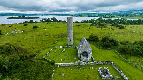
Scarriff Harbour to Holy Island
Distance
3 km
Duration
45m
Start point
BallycuggeranEnd point
BallycuggeranDifficulty
Beginner
Description
As you depart Twomilegate, you pass the University of Limerick Activity Centre (ULAC), You then pass a headland (1.3 km). Annacarriga holiday resort and marina is on the other side of this headland. Return by the same route. This journey may become Intermediate grade in windy conditions.
-
Trail difficulty level Advanced
- 17.3 km
- 5h 45m
- Linear
Ballycuggeran to Scarriff Harbour
Distance
17.3 km
Duration
5h 45m
Start point
BallycuggeranEnd point
Scarriff HarbourDifficulty
Advanced
Description
Turning left (North), as you depart Twomilegate, you pass the University of Limerick Activity Centre, and keeping close to the lake shore you pass the Annacarriga holiday resort and marina (1.4 km). The bank begins to veer North East at Tinarana Bay (3.5 km), passing some large private houses and then turning more northerly at Carrowgar bay. There is a small private harbour, farmland and then forest as you continue towards at Aughinish point. The lake shore turns West into the large Scarriff Bay and there is a grassy egress bank at Ballynagleragh just after the forested headland. There is a long island causeway at 12.4 km and then the mouth of the Scarriff river is in the far West of the bay. Travel up the Scarriff river passing Reddan’s pier at Tuamgraney and then turn left into Scarriff harbour.
This is the longest trail and is only suitable for intermediate to experienced paddlers with reasonable levels of fitness. The wind effect on the water may not be visible until you round the headland into Scarriff bay, you should allow for a shorter journey to Ballynagleragh in the event of poor weather or tiredness.
-
Trail difficulty level Advanced
- 12 km
- 4h
- Linear
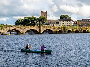
Castlelough Public Park to Killaloe Canal
Castlelough Public Park to Killaloe Canal
Distance
12 km
Duration
4h
Start point
Castlelough Public ParkEnd point
Killaloe CanalDifficulty
Advanced
Description
You move away from the lake and towards the river by travelling left (South West), as you depart Castlelough. Follow the shore which is lined by a narrow strip of trees until the river narrows further and turns due south (7.3 km). You can continue along this east bank or experienced paddlers may cross to the Western bank of the river (1 km wide), towards the site of what was Brian Boru's fort. The river subsequently narrows considerably where you cross the river to the west bank, be aware of the water traffic and find the entrance to the Killaloe canal (11 km). You travel down the Killaloe canal where there may be a small water barrier which can be portaged on the right via a small slip. Then travel approximately 500 metres under the main bridge and then exit at the low canal bank on your left just after the public car park. Please note that most of this trail is into the prevailing wind with little shelter.
-
Trail difficulty level Beginner
- 2.5 km
- 50m
- Loop
Killaloe Canal Loop
Killaloe Loop
Distance
2.5 km
Duration
50m
Start point
The Mill Yard, KillaloeEnd point
The Mill Yard, KillaloeDifficulty
Beginner
Description
Enter the Killaloe canal at the car park on the bridge, travel upstream (North), under the pedestrian and the road bridge and then portage around the small water barrier via the small slip, thereafter exit the canal onto the river. Turning to your right (South) select an appropriate place to cross the river towards the left bank, well in advance of the road bridge. Line up for the navigation markers and channel, left of the bridge centre and pay attention to other boat traffic in this area. Do not pass through any of the other arches on the road bridge. After the bridge move to the right of the river, you can re-enter the canal further downstream (2 km), and return upstream (North) to the start. This journey may become Intermediate grade in windy conditions.
-
Trail difficulty level Beginner
- 5 km
- 3h 40m
- Linear
Killaloe Canal to Ballycuggeran
Killaloe Canal to Ballycuggeran
Distance
5 km
Duration
3h 40m
Start point
The Mill Yard, KillaloeEnd point
BallycuggeranDifficulty
Beginner
Description
Enter the Killaloe canal at the car park on the bridge, travel upstream (North), under the pedestrian and the road bridge and then portage around the small water barrier via the small slip, thereafter exit the canal onto the river. Continue along the left bank (West), pay attention to motor traffic at the entrance to the two nearby large marinas. The river then broadens out at the site of Brian Boru’s fort (2 km). The bank is dotted by three small bays and a number of houses and small private piers. Pass around the narrow tree lined headland, which has a number of pontoons along its edge and then finish the trail at the grass or pier area. This journey may become Intermediate grade in windy conditions.
-
Trail difficulty level Intermediate
- 9 km
- 3h
- Linear
Scarriff Harbour to Holy Island
Distance
9 km
Duration
3h
Start point
Scarriff HarbourEnd point
Holy IslandDifficulty
Intermediate
Description
A long journey which is reasonably sheltered with exits at Ducey’s Pier. Suitable for intermediate paddlers with reasonable fitness.
Turn right as you depart the marina into the Scarriff river and pay attention to the motor cruiser traffic. You pass Reddan’s pier (0.7 km) and then a marina on the left bank. You then exit the river (2.3 km), and pass Lucey’s Pier on the left which may be a convenient finish point. Continuing around the bay you will arrive at the Holy Island pier on the lake shore. From here it is 250 metres across to the island. You may want to land on the far side of the island, if the weather allows, as the nearer West side can be very mucky.
No results to display here yet, please check back soon.
Showing n-m of p results
Skip the list-
Trail difficulty level Intermediate
- 165 km
- 45h
- Loop
East Clare Way
Circular route through villages and wild areas with varied terrain.
Distance
165 km
Duration
45h
Start point
KillaloeEnd point
Killaloe
Difficulty
Intermediate
Description
The East Clare Way is a 165 km circular walking route that wends its way through the wildest part of the region while touching on its many villages. Terrain consists of mainly quiet tarmac roads, forestry tracks, bog roads, open ground and field paths.
No results to display here yet, please check back soon.
.webp?ext=.webp)
.webp?ext=.webp)